Route 05
Open ground with almost no shade, and why it stays in the index
Every other route here was chosen because it survives August. This one does not, and it earns its place on the other seven months and on the fact that nobody else is ever on it.
The southeast side of the city flattens out into old farm ground with a creek running through it. There is a trail along the creek, most of it mown grass with sections of packed dirt and one gravel service road.
There is almost no canopy. That single fact governs everything below.
The walk
Two and eight tenths of a mile out and back along the creek and a service road. One hour forty five, walked deliberately in the worst month, starting at seven in the morning at eighty eight degrees and finishing at ninety nine.
The record exists partly to say what that is like, because a journal that only publishes comfortable ground is not telling the truth about this city.
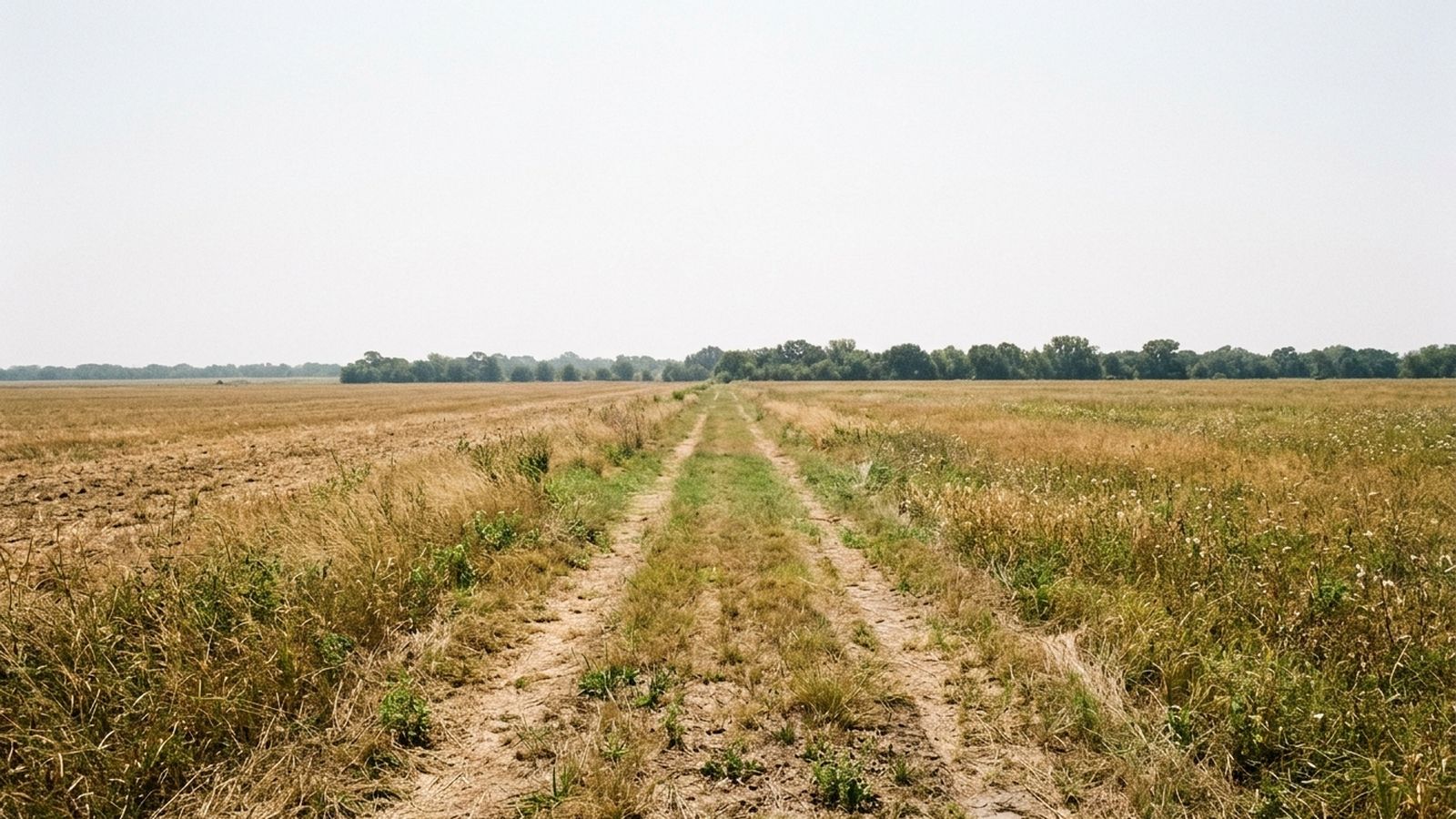
The shade, such as it is
One fifth of the route, in two clumps: a stand of hackberry at three quarters of a mile, and a longer line of pecan near the turn. Between them there is nothing, and the mown grass reflects heat upward as well as taking it from above.
In July the two clumps are not amenities, they are checkpoints. This record walked from one to the other and rested in both, which is a strategy rather than a stroll.
The water
One reachable point, at the pecan line, where the bank steps down to a gravel edge. In July it was a pool with no flow. In a wetter month it is a proper crossing.
It is not dependable, and that word is doing real work: a route with one water point that may be dry is a route where the water has to be carried. Two litres for a walk of under three miles sounds excessive and was not.
Why it stays in the index
Three reasons, and the first is the honest one.
- 1. Nobody is there. In two hours in July this route had one other person on it. On any route in the first half of this index there would have been forty.
- 2. From late October to early April it is excellent. Flat, open, dry underfoot, big sky, and the same emptiness. Two hours of easy ground with nothing to negotiate.
- 3. It is flat. Genuinely flat, on grass and packed dirt, which for an animal that cannot do stone or steps makes it more useful than the prettier routes.
Ground that is unwalkable for four months and excellent for seven is worth writing down. Ground that is pleasant for four months and dangerous for the rest is the thing worth warning about, and in this city those two get confused constantly.
The signs
Transcribed: a lead is required, posted at the trailhead and again at the service road. There is no off lead area on this route.
The one thing not to do
Do not come here at four in the afternoon in July because it looked flat and short on a map. Flat and short with no shade and no water is the most dangerous combination in this index, and it is the only route here where this journal says so in those words.
Before you go
- Walked
- 19 July 2026
- Distance
- 2.8 miles
- Shade
- one fifth, and only in two clumps
- Water
- one reachable point, not dependable
- Surface
- mown grass, packed dirt, gravel road
- Signed
- lead required throughout
- Best hours
- the first hour after sunrise, and nothing else in July
This is the hardest route in the index and it is in here as a warning as much as a recommendation. One fifth shade, one water point that is not dependable, and open grass that reflects heat upward. In July it is a sunrise walk or it is nothing. In November it is a genuinely fine two hour walk with the best sky in the index.